Modifying an Existing Coordinate System
The Custom tab also contains the coordinate system settings for the US state plane system (under the State Plane tab) as well as Israel and China (under the Coord Sys tab).
To modify one of these existing coordinate systems:
- Select the coordinate system from either the State Plane tab or the Coord Sys tab.
- ClickApply to temporarily set the coordinate system.
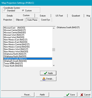
Selecting an existing state plane populates the other tabs with the coordinate systems values
In the example below, the Oklahoma South (NAD27) state plane coordinate systems is selected. Once you've selected the coordinate system to modify,
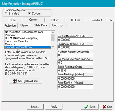
Going back to the Custom tab shows that all the settings for the given coordinate system are loaded in. Every one of these settings is now modifiable.
- Select Save to enact the changes.
For new projects this will simply set the project's map projection. For existing projects, saving a different coordinate system means that the XYs of all the data will need to change as well.
- Select Yes when Petra asks to recompute XY well locations using the new map projection.